Wednesday, June 29, 2011

Mt Baldy and Devil's Backbone


Mount Baldy:
Trail Stats: Ski Hut Trail via Manker Flats
Mileage (r.t.) 8.4
Trailhead 6160'
Baldy Summit 10,064'
Total gain 3900'
Gain per mi. 928'

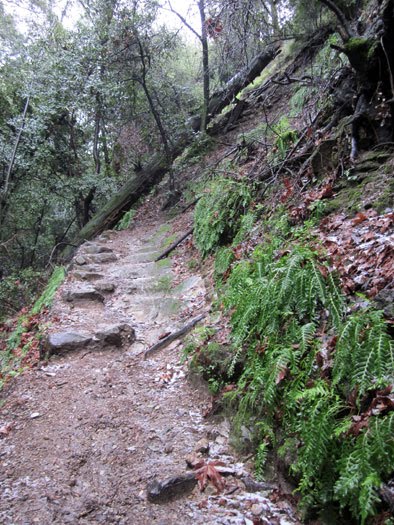
Hello fellow hikers we hiked Mt. Baldy this Saturday and it was a big challenge for everyone. This was not a beginner hike. We had a snack brake around half way up, by the Sierra Club green hut, and a light lunch once we got to the top. Then we hiked down the Devil's Backbone trail. It was a beautiful day!

Parking at Manker Flat campground requires an Adventure Pass ($5 for the day), which you need to purchase in advance. Passes are available at numerous sporting goods stores, including Big 5.

Getting to the Trailhead:

From the new 210 Freeway extension, driving east: Exit Baseline Road in Claremont. Turn left on Baseline. In one block turn right unto Padua Avenue. In 1.7 miles turn right onto Mt. Baldy Road (stop sign). After 7.2 miles you pass the Angeles National Forest Mt. Baldy Visitor Center in Mt. Baldy Village. Continue a few miles up to Manker Flats.

From the new 210 Freeway extension, driving west: In Upland, exit Mountain Ave./Mt. Baldy Exit, Exit 54. Turn right and proceed north on Mountain Ave. Drive 5 miles to Mt. Baldy Road. Turn right (north) and after 5 miles you pass the Angles National Forest Mt. Baldy Visitor Center in Mt. Baldy Village. You can get a Forest Adventure Pass here. Continue a few miles up to Manker Flats. Park at upper end of Manker Flats Campground in one of the dirt areas near the gated Falls Road on the left (if you reach the ski lift parking lot, you've gone too far)

Saturday, February 26, 2011

Mt Wilson Orchard Camp

From Mt. Wilson Trail Drive, walk up the drive to the beginning of the trail on your left. Follow the trail up to a ridgetop road where you will see another trail sign on your left. The trail will begin to climb, high on the slope of Little Santa Anita Canyon. Past the one-mile marker are switchbacks which wind up the trail. At 1.5 miles go to your left (see photo with sign 2.0mi from Orchard Camp, if you go right you go down to the creek) and continue up the trail. The trail narrows west into Lost Canyon where you will cross the steam. From lost canyon you are rewarded with a nice view down into cyn. Here are lots of shady areas and oak canopy.

The trail moves on high above the canyon with great views. You descend slightly for a few minutes as the trail rounds around several ravines through some dense forest. You'll pass a three-mile marker (green wooden stake on your left). You'll hear and see the creek far below. After you head down a ways you will arrive at Decker Springs. Past the springs, follow the switchbacks on... there are lots of down oaks and you have to crawl under several before you round around to reach the shady site of Orchard Camp. Here is a wonderful area to enjoy the beauty and have some lunch unless of coarse it is pouring rain, hail or snowing and super cold. Then as we did, stay briefly, and head back down the same trail. Total 7 miles roundtrip.

To Get Here:
210 exit is Santa Anita N.
Lt Grandview
Rt or North on N. Mtn Trail Ave
Lt on Mira Monte ave.
Rt on Mt. Wilson Trail. (Park here right as you turn, can't park up the road.)
Also there is a little Museum 'Lizzy's' open 2 days a mo, or so. It is really cool and it used to be the home of
Benjamin Wilson. Read the story here http://www.simpsoncity.com/hiking/news/SGVT021306.html.