
NEW SITE FOR THIS BLOG IS HERE:
http://jenniferswain.com/angelestrails/
Wednesday, February 13, 2013
Thursday, November 29, 2012
Mt. Islip Loop

A decade after the Curve Fire destroyed more than 20,000 acres of the Angeles National Forest, the damage to the areas surrounding Crystal Lake basin are still very apparent. Through the dedicated work of the San Gabriel Valley Trailbuilder volunteers, a passable trail has been cleared to the top. Photographers will love the beauty of the charred subjects and new growth along the way, as well as the views at the top of Mt. Baldy, Old Saddleback, the San Gabriel Valley, the Mojave Desert, and of course, Crystal Lake.
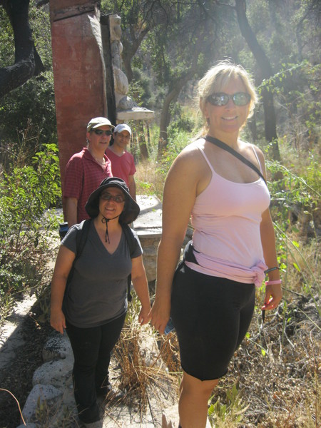
We’ll start at a slow pace up Windy Gap to acclimate to the elevation (our starting point is at about 5,600 ft.) to a carved log bench at the junction of Windy Gap and the Pacific Crest Trail. From there we’ll detour to visit the lovely Little Jimmy Campground, see if the spring is running and take a break before heading up to the summit. We’ll pose for some shots around the ruins of a stone cabin before heading down via Islip Ridge to Big Cienega, for a gradual descent back to the Mt. Hawkins Fire Road. There we’ll retrace part of our way on the Windy Gap trail to our starting point.
STATS
Level: Moderate
Gain: ~ 2,600 ft.
Distance: ~ 10+ miles
Time: ~5+ hours
Type: Dirt single track trail, loop. Pending weather, trail may have some snow/ice.
Dogs: Permitted on leash, but not advised.
Water: Available at trailhead
Restrooms: Available at trailhead and at Little Jimmy Campground
Parking: Carpool drivers: park in the day use parking lot, just past the Crystal Lake Visitor Center, near the restrooms. National Forest Adventure Pass required ($5/day; $30 annual pass - available at REI, Sports Chalet, Big 5 or at the Forest Gateway Ranger Station at 1960 N. San Gabriel Road, which open @ 7 am Saturday). Carpool riders, see directions below.
Bring: Three liters of water, lunch/snacks to share/gobble (extra points for yummy Thanksgiving leftovers) and cold weather clothing: layers, windproof jacket, gloves, hat, sunscreen, lugsoles. Poles will be helpful as the route may be slick.
DIRECTIONS
From the I-210 in Azusa, take the Highway 39 (Azusa Ave.) exit and head north; Azusa turns into San Gabriel Canyon Road.
Here’s a map to the Crystal Lake Recreation Area. (The Visitors’ Center is across the street from the Crystal Lake Café, at 9877 Crystal Lake Road in Azusa.


Sunday, October 7, 2012
Stunt High Trail to Saddle Peak

We begin with a bucolic (shaded and flat) walk along Cold Creek, complete with a few benches for stream-gazing (though not much water this time of year). Then we’ll turn and start climbing, passing a meadow and a side trail to the UCLA-owned Stunt Ranch eco-classroom, which was named for family that originally homesteaded the area in 1885. The structure on the reserve was destroyed in the 1993 Malibu-Topanga Fire, but a new facility is scheduled to open next year.
After passing a paved service road, we’ll continue climbing until we come to our first junction with Stunt Road. Anyone wishing to turn around here can do so for a three-mile roundtrip.
Those continuing will turn right and head uphill, then cross the road to pick up the continuation of the trail, a series of switchbacks that flatten out eventually. We’ll be able to see Calabasas Peak (2,163 ft) occasionally through breaks in the cover. After another 1.5 miles, we’ll come to a second junction with Stunt Road, marking the turnaround point for a six-mile roundtrip.
The third leg will take us across Stunt Road to join the Backbone Trail for another 1.1 miles, past some impressive sandstone formations (most likely sporting climbers), then it’s on to Saddle Peak (2,805 ft.), where we’ll take a break and take in the views before returning the way we came.
If you have the time afterward, you may want to visit the nearby King Gillette Ranch at 26800 West Mulholland Highway (at Las Virgenes Road) in Calabasas. This former home of the razor company founder is now the new Interagency Visitor Center for a number of state and local park and conservancy offices. There are also some short hiking trails at the Ranch. Parking is $7 but you can also park along Los Virgenes or Mulholland and walk into the property. Malibu Creek State Park (“M*A*S*H” filming site) is also around the corner, just south of Mulholland on Los Virgenes.
STATS
Level: Moderate
Gain: ~ 1,800 ft
Distance: 8.2 miles (with options for turnarounds to make a 3- or 6-mile RT)
Time: ~ 4+ hours to Saddle Peak
Type: Out and back, wide and single track dirt trail
Dogs: Permitted on leash
Water: Not available at trailhead
Restrooms: Porta-potty at trailhead
Parking: Free (but limited, since this lot also serves two other trailheads) in a small dirt lot at the trailhead.
Bring: At least 2-3 liters of water, sunscreen, hat, snacks to share
DIRECTIONS
An approximate address for Google Maps is 1665 Stunt Road, Calabasas, CA 91302.
From the 101, exit south on Las Virgenes Road for 3.1 miles. Turn left on Mulholland and continue 4 miles to Stunt Roaad. Turn right on Stunt for about a mile to a dirt parking area on the right side of the street/west side of road. There’s a small sign that says “Stunt High Trail” at the lot (but it’s not visible from the road).
From PCH, take Malibu Canyon Road 4.6 miles to Piuma. Take a right on Piuma, go 0.8 miles and take a left on Cold Canyon. Go 2.1 miles on Cold Canyon, bear right onto Mulholland, go 0.8 miles and take a right onto Stunt Road and follow the directions above to the lot.


Saturday, September 29, 2012
Canyon Trail, Big Tujunga Canyon

Then, you’ve come to the wrong meetup.
This hike is so lazy, it couldn’t come up with a more provocative name than by using “trail” twice.
But given the expected high 90s/100s temperatures Saturday, this fits the bill as it’s: short, in the shade of canyon walls for at least a bit, and does end at what is described by some as a “falls,” but more truthfully, I'd call it, “Trail Canyon Trickle.” Plus, we haven’t hiked in the ‘hood before, and it avoids the dreaded Carmageddon II corridor. Case closed.
Yucks aside, this recently-reopened trail (closed since the Station Fire until May of this year) does offer some adventure-lite fun, some interesting ruins of burned cabins (a bit like Solstice), as well as very pretty views of Condor, Fox and other peaks in Tujunga.
We’ll start by heading up a fire road, arriving soon at the ominous “Trail Not Maintained” sign (shiver), where the road narrows to a trail. We’ll climb up a ridge, then descend to a creek passing over a treacherous bridge of four logs that is at least 18” -- maybe even 24”! -- above the water. From there we’ll wind up and down narrow trails, cross the shallow stream a few times, scramble over an occasional downed tree trunk and some rocks in a dry creek bed before starting a steady, long climb out of the canyon.
After the trail flattens out a bit, we’ll turn to the west and see the Falls/Trickle in the distance. We’ll continue on the trail until it joins the creek upstream of the falls, then rock hop/stroll down to the top of the Trickle to peer over the edge to the pool it dribbles into, about 50 ft. below. We’ll take a break here on the rocks, then climb up a short, steep route to rejoin the main trail. If it’s hot enough out, and if there’s enough water in the pool below the falls to make it worth the trek, any real Doras can try a steep path down from the main trail down to the pool (bring gloves if you’re interested in trying this). Then we’ll return back the way we came.
STATS
Level: Advanced Beginner
Gain: ~ 700 ft.
Distance: ~ 4.5 miles
Time: ~ 3 hours
Type: Fire road, single track dirt, minor rock scrambling, out and back
Dogs: Permitted on leash, but not recommended due to trail conditions
Water: Not available at trailhead
Restrooms: Not available at trailhead; they may be available at Sunland Park (see carpool location), or at the Shell Station or Starbucks near Oro Vista and Foothill.
Parking: National Forest Adventure Pass required, $5/day from Big 5, Sports Chalet, REI, other sports stores
Bring: Water, sunscreen, hat, boots or trail runners with good treads (no tennis shoes), snacks to share at our break. Gloves if you want to try the brushy scramble to bottom of falls.
DIRECTIONS:
The biggest adventure with this hike may be finding the parking lot. I suggest you print these out for reference, as there is no cell phone service at the trailhead. Call me before Saturday if you have any questions.
If you don’t have an Adventure Pass and want to carpool or can drive for the carpool, email Shawn.
Directly to the Trailhead
An approximate address (per Google Maps) for the trailhead is 4108 Big Tujunga Canyon Road, Sunland, CA 91040.
From the 210 East or West, exit at Sunland Blvd. (Exit #11) and turn North towards Sunland – Tujunga.
Take Sunland Blvd. (which becomes Foothill) about .8 miles to Oro Vista Ave. and turn left (after the Jack in the Box). Note there’s a Starbucks just past Oro Vista on the left). Continue on Oro Vista Ave. until it curves to the right and becomes Big Tujunga Canyon Road. If you zero your odometer at the end of Oro Vista, it’s about 4.4 miles to a dirt road turnoff for Road NF 3n-29, where you’ll turn left to drive to the trail head. This turn is very easy to miss, so please be alert.
Some signposts/landmarks along the way: about 3 miles after getting onto Big Tujunga Canyon Road, you’ll pass the “Entering Angeles National Forest” sign on your right. Later, you’ll see a small green/white sign for Thundering Hooves Ranch on your right and then you’ll go over a bridge. The left turn will not be too far beyond that. If you pass Ottie Road to your right, you’ve gone too far; turn around and watch for the turn off that will now be on your right.
Once you’ve turned from Big Tujunga Canyon onto Road NF 3n-29, drive slowly as the fire road is rough. When you come to a Y in the road, stay to the right on Trail Canyon (the left takes you to Gold Creek) and continue to the parking lot at the end where we’ll meet. You’ll see a stone cabin to your right.
It’s about .4 mile from Big Tujunga Road to the Trail Canyon parking lot. Remember to display your Adventure Pass from your rearview mirror or dashboard.


Subscribe to:
Posts (Atom)