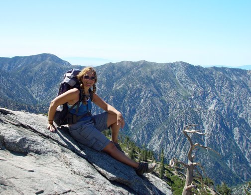

Old Baldy, the tallest in the San Gabriel Mountains. 10,064 feet starting a Manker Flats (about 6,300 ft.).
If you haven't done Baldy, you are in for a treat. One of the most amazing views from the summit and even before the summit.
This is not an easy hike at all. It is strenuous. You need to be in good shape. Using the lift it is 3.6 miles, 2,264 gain. The beginning and the very end are very hard, but the middle part is easy, and it's one of the most beautiful views in the San Gabriels. You are walking through this trail over 8,000 feet with views on both sides! Breathtaking. You will need 18 bucks if you take the lift for ticket up and down. We hiked up the trail (not using the lift) and it is long.
There is a ski hut & Port-a-potty about 1/2 way. That's a 5.5 miles 4,300 ft. hike. It took about 4-5 hours.
At the summit, we hung out for a little bit, and you can go down the Devil's Backbone trail and take the lift down to your cars or take the trail back down, 11 miles round trip.
Bring: Warm clothes (it is very cold at 10,000 feet, especially if it gets windy), water (2 liters for the gnarly group, 3 for the laid back (there is no water on the devil's backbone trail), food and/or snacks and money for the lift. YOU ALSO NEED AN ADVENTURE PASS FOR PARKING. You can get that on your way at the Baldy Visitor Center. I think it's five bucks for the day.
Directions to Maker Flats
From the 210 freeway, take the Mountain Ave. / Mount Baldy exit from either freeway, which is located in the city of Upland and head North towards the mountains. Mountain Ave. will turn into Mt Baldy Road. Keep following Baldy Rd. through Baldy Village, then through some very windy part with 6 or 7 crazy switchbacks and when the road splits (one side up, one side down) you are at Manker Flats. You will pass Snowcrest Inn to your left, Angels Forest Campground to your right, the snack bar to your right again (all very close), keep driving for a few hundred feet to where there is a sign to your right saying "San Antonio Falls Road". Make a left U turn. You'll also see the two port-a-potties right at the beginning of the trail. I'll be right there. Approx. 14Miles.
There are a couple of other exits named Mountain Ave. off the 210, so make sure to take the one that says Mountain Ave./Mt. Baldy. Cell phones don't work over there.